SONS OF DEWITT COLONY TEXAS
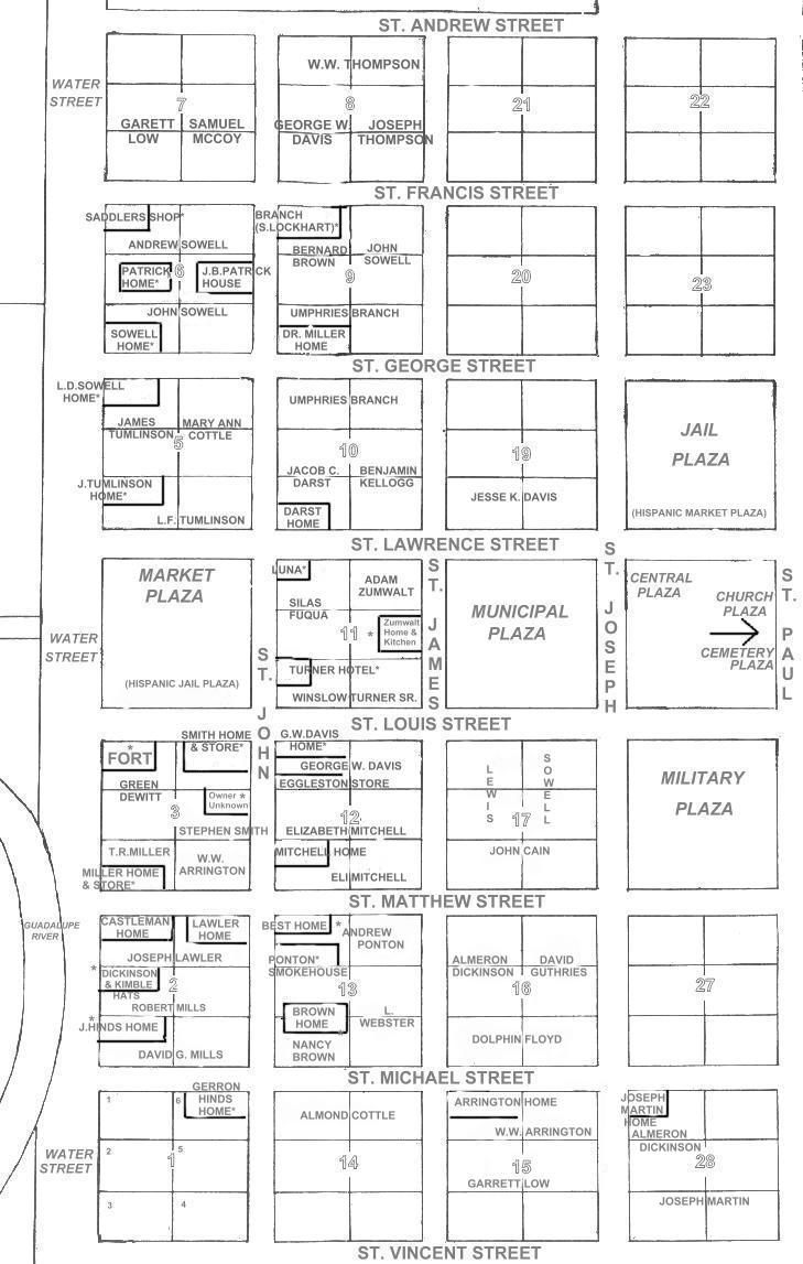
Lots within blocks are numbered 1 to 6 counterclockwise beginning in the upper left corner of the block, see Block 1 lower left. Structures with owners names are indicated by enclosures, unboxed names indicate owners of lots purchased from Gonzales alcaldes. The 28 westernmost blocks of the total of 49 are indicated. The location of structures is according to the 1903 map drawn by David Sterling Hughes Darst from memory just before they were burned in 1836. According to Darst, Block 8 had been agreed by townspeople to be set aside for a school which was under construction in 1836. The location of Jail and Market Plazas specified by commissioner Navarro according to Hispanic tradition were switched by usage early in development of the town. |