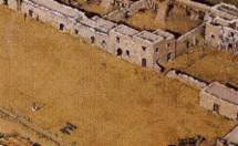
The
Alamo Well
The location
shown here is conjectural, although it is fairly close to the well shown on
the  Sanchez-Navarro
map. The location shown on the
  Green
B. Jameson plat places the well just to the left of the Southwest corner
of the Long Barracks, Still another theory places it within the courtyard
of the Convento (Horse Corral)
Visitors to
the Alamo often ask about the well located behind the long barracks. This well
is not original and is of modern construction. Despite reports to the contrary,
it is doubtful that a well ever existed here for on the various maps drawn by
Navarro, Jameson and Potter, this well is conspicuously missing. Later photos
of the site clearly show that there was no well. Most likely, this was a "proposed"
well for the Convento, much the way the San Antonio de Valero chapel was the
"proposed" church for the Mission. When the chapel collapsed and mission was
abandoned in 1794, any plans for a well were abandoned too.
With the presence
of a nearby acequia and the close proximity of the Rio de San Antonio, such
a well would have only been necessary in time of siege. According to Navarro's
map, the well that was present during the battle was in the larger compound
area and much further to the West. The Convento area was examined by archaeologists
in 1967, but little of significance was found. In 1995, archaeologists made
an unsuccessful attempt to find the well described on the Green Jameson map.
This was located immediately in front of the chapel at the southwest corner
of the long barracks. This excavation yielded little more than some interesting
geological data and a few mission-period artifacts. So Jameson's well was either
incorrectly drawn or was, like the Convent well, only a proposal.

![]() Sanchez-Navarro
map. The location shown on the
Sanchez-Navarro
map. The location shown on the ![]() Green
B. Jameson plat places the well just to the left of the Southwest corner
of the Long Barracks, Still another theory places it within the courtyard
of the Convento (Horse Corral)
Green
B. Jameson plat places the well just to the left of the Southwest corner
of the Long Barracks, Still another theory places it within the courtyard
of the Convento (Horse Corral)